A tide gauge built from reflected satellite signals.
Most of Kenya's ~530 km of coast has no sea-level record at all. This feasibility study asks whether a network of low-cost, ground-based GNSS Interferometric Reflectometry stations could close that gap — and finds that six candidate sites would each deliver tide-gauge-class sampling, plus something a tide gauge cannot: a measurement of the land's own vertical motion.
Africa's coast is a hole in the sea-level map
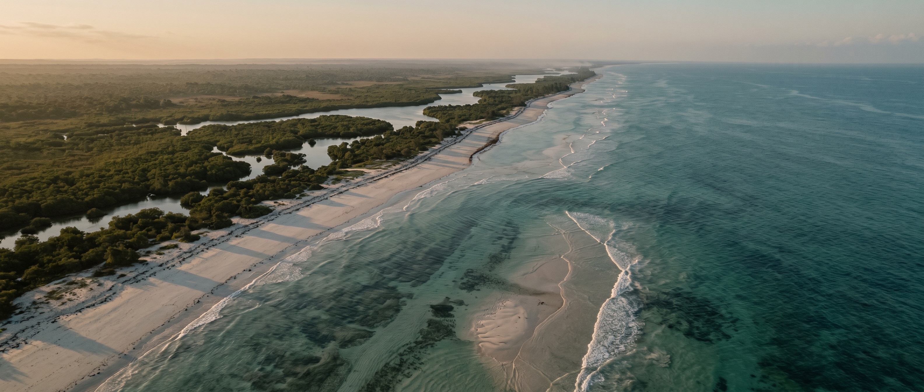
Knowing how fast the sea is rising depends on measuring it, and Africa is one of the largest gaps in the global sea-level observing system. Tide gauges are sparse, unevenly distributed and of varying quality, and the East African coast is especially poorly instrumented — despite low-lying, erosion- and flood-prone shorelines. In Kenya, the port of Mombasa hosts one of the region's few long records, while the remaining ~530 km of coast — Lamu, Malindi, Kilifi, Diani, Shimoni — is effectively unmonitored.
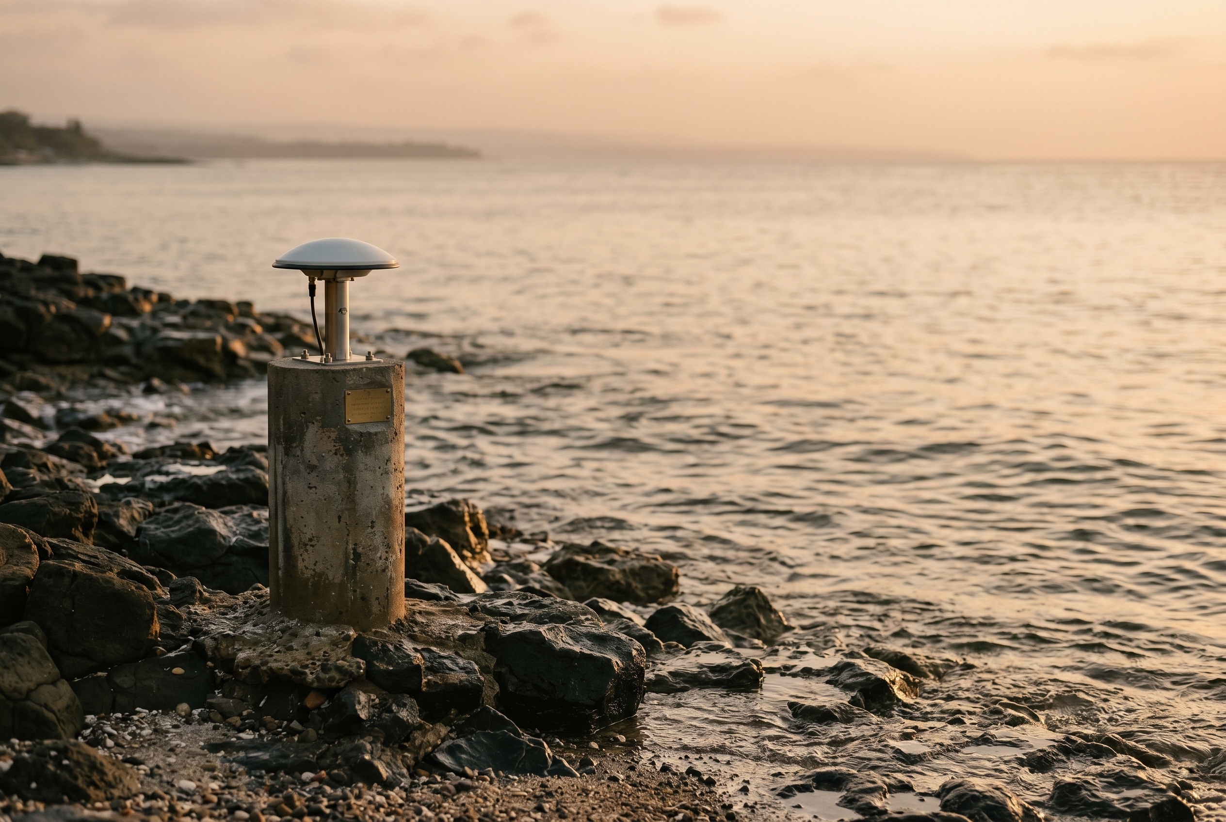
Ground-based GNSS Interferometric Reflectometry offers a low-cost way to close that gap. A single geodetic station at the coast listens for the navigation signals that reflect off the sea and reads sea level from the interference between the direct and reflected paths recorded in its signal-to-noise data. It performs like a tide gauge — with daily-mean accuracy below 1.5 cm and around 350 water-level estimates a day when four constellations are tracked — and, crucially, it simultaneously measures the antenna's own vertical land motion.
The receiver costs a fraction of a conventional gauge, runs on existing geodetic infrastructure, and answers a question a tide gauge cannot: is the sea rising, or is the land sinking beneath it?
The method: counting usable sea-reflection arcs
This study is a side-project of GWO's spaceborne GNSS-R work and reuses that validated orbit and constellation code, adding the ground-based observing geometry. For six candidate stations along the Kenyan coast, the simulation propagates all four constellations and, at every epoch, computes each satellite's elevation and azimuth in the station's local frame.
A reflection is counted as usable only when two conditions hold together — and each continuous arc through that window yields one sea-level estimate:
- Condition one
Low elevation band
The satellite sits between 5° and 25° elevation, where GNSS-IR sea-level retrieval is performed and the reflection grazes the water.
Footprint ≈ antenna height ÷ tan(elevation) - Condition two
Seaward azimuth sector
The satellite's azimuth falls within the station's open-water sector — the range of directions actually facing the sea rather than land.
~180° at open sites, ~160° where the coast curves in
The analysis is deliberately geometric: it quantifies coverage and sampling rate, not retrieval precision, which is taken from the published literature (< 1.5 cm daily-mean). The question it answers is the first one any deployment must clear — is there enough usable geometry, often enough, facing the right way?
What the simulation shows
All six sites are strongly feasible. The headline numbers below carry the finding; multi-GNSS is what lifts every station to tide-gauge-equivalent performance.
Where the network would sit
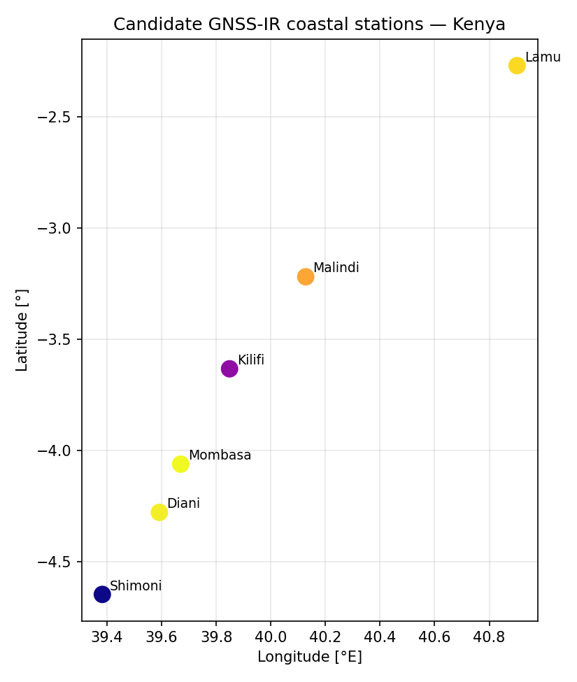
The six candidate stations span the coast from Lamu in the north to Shimoni near the Tanzanian border — co-locating one with the existing Mombasa gauge for cross-validation, and placing the other five along the stretch that has no record at all.
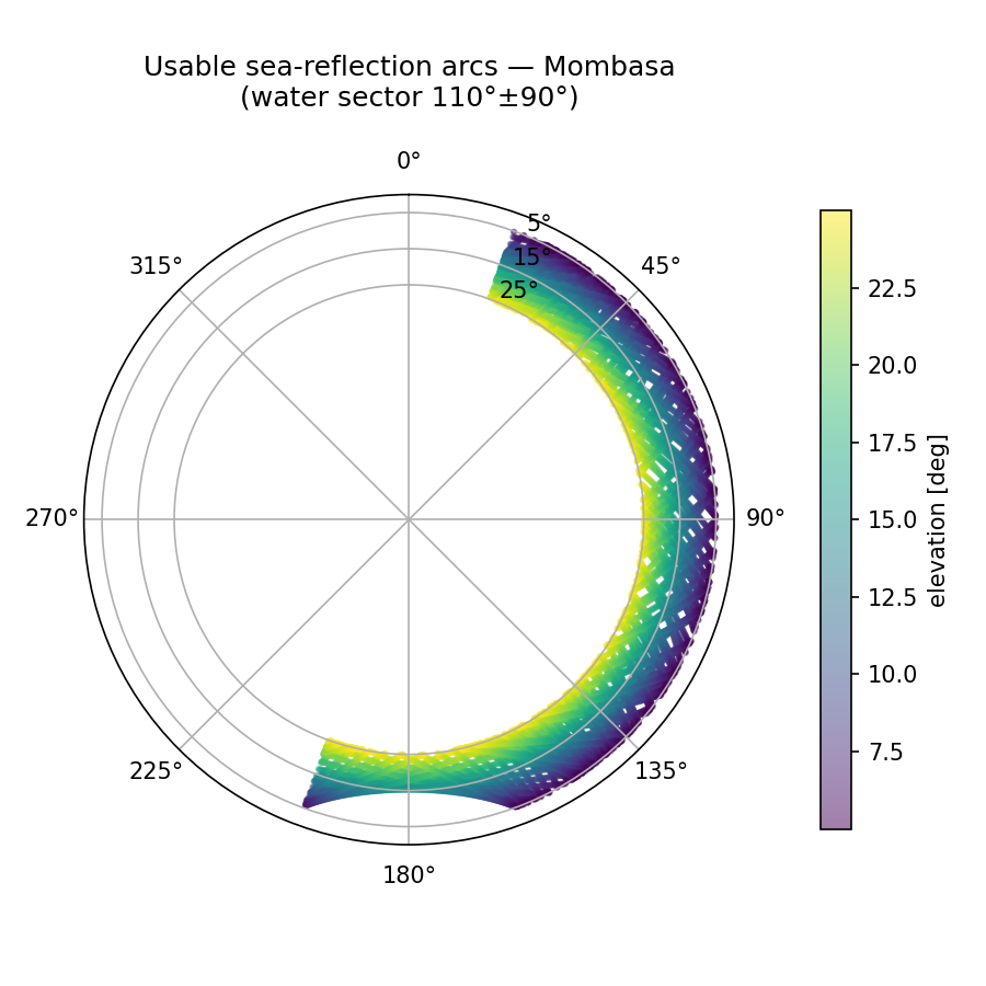
The sky plot makes the geometry concrete: at Mombasa the open-water sector (≈110° ±90°) is densely filled with low-elevation arcs from every constellation, so the sea surface is sampled across all offshore directions rather than along a single track.
Multi-GNSS is the whole story
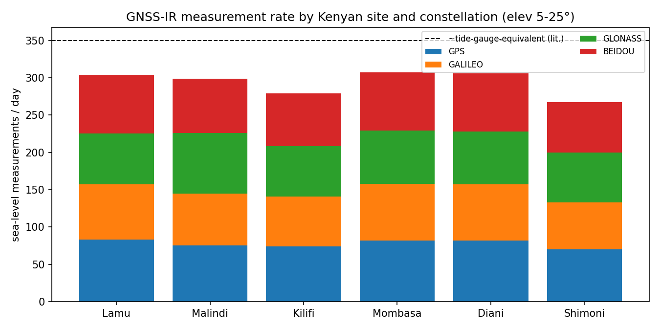
The single most decisive result is how much the other three constellations add. GPS alone yields only ~70–83 measurements a day per site — useful, but well short of tide-gauge cadence. Stacking Galileo, GLONASS and BeiDou on top roughly quadruples the rate to ~270–310/day and shortens the median gap between estimates from about sixteen minutes to three.
| Site | Lat, Lon | Multi-GNSS /day | GPS /day | Median gap | Seaward coverage |
|---|---|---|---|---|---|
| Lamu | −2.27, 40.90 | 304 | 83 | 3.2 min | full (180°) |
| Malindi | −3.22, 40.13 | 299 | 75 | 3.2 min | full (180°) |
| Kilifi | −3.63, 39.85 | 279 | 74 | 3.5 min | 160° |
| Mombasa | −4.06, 39.67 | 307 | 82 | 3.2 min | full (180°) |
| Diani | −4.28, 39.59 | 306 | 82 | 3.2 min | full (180°) |
| Shimoni | −4.65, 39.38 | 267 | 70 | 3.4 min | 160° |
Sites with a narrower open-water sector (Kilifi, Shimoni) lose only modestly. Every station clears tide-gauge-class sampling.
Why it beats a tide gauge, not just matches it
The network's real value is greatest precisely where Kenya is blind today — and it does one thing a tide gauge fundamentally cannot. A gauge measures sea level relative to the land it stands on; if that land subsides — a real risk in deltaic and reclaimed coastal ground — it silently over-reports sea-level rise. A GNSS-IR station measures both at once.
- Conventional tide gauge
Relative sea level
Reads the water against its own structure. Land motion is invisible to it, so subsidence and true rise are entangled in a single number.
One measurement, two confounded signals - GNSS-IR station
Absolute sea level + land motion
Measures the reflecting sea surface and its own vertical position — yielding absolute sea-level change and an independent subsidence estimate from one instrument.
The key advantage for attributing flood risk
That separation is the crux for a coast where both processes are in play. Add ~3-minute sampling — fast enough to resolve tides and storm surges, not just long-term trends — and the network supports flood early-warning as well as climate monitoring, on infrastructure that is cheap to install and maintain.
What it would take to deploy
The study is a feasibility screen, not a deployment plan. Three steps stand between this result and stations in the ground.
Close the coastal gap
Co-locate at Mombasa for cross-validation and a land-motion reference; add Lamu, Malindi, Kilifi, Diani and Shimoni to instrument ~500 km of currently unmonitored coast.
Separate rise from subsidence
Exploit the simultaneous vertical-land-motion measurement to report absolute sea-level change — the decisive advantage for attributing coastal flood risk.
Resolve the short timescales
~3-minute cadence captures the tidal cycle and storm surges, extending the network's use from long-term trends to flood early-warning.
Survey each horizon
The sea-azimuth sectors and antenna heights are first-order estimates. Each site needs a local horizon and shoreline survey to fix the usable sector and rule out obstructions and rough-surface multipath.
Simulate the retrieval
Move beyond geometry: an SNR forward model with tidal range and sea-state coherence loss would quantify achievable per-site precision rather than relying on the literature value.
Trial against the gauge
Field one low-cost station beside the Mombasa gauge for validation, then weight wider East/West African site selection by population and flood exposure.
A multi-GNSS coastal GNSS-IR network is a technically sound, low-cost route to closing Kenya's sea-level monitoring gap — not merely a substitute for tide gauges but, on vulnerable low-lying coasts, an improvement on them.
Sources & data
Feasibility study reusing GWO's spaceborne GNSS-R orbit and constellation code, extended with ground-based GNSS-IR geometry over six Kenyan coastal sites. Retrieval performance figures (< 1.5 cm daily-mean, ~350 measurements/day) are drawn from the published GNSS-IR sea-level literature — Larson (2008); Measuring Coastal Absolute Sea-Level Changes Using GNSS-IR (Remote Sens., 2021); Ground-based high-frequency sea-level monitoring from multi-GNSS reflectometry (GPS Solutions, 2025) — and from GLOSS/IOC-UNESCO coverage assessments. For full methods and references, please get in touch.
Need to instrument a coast before the sea catches up?
If you are weighing how to monitor sea level, subsidence or flood risk along a stretch of coast — what a low-cost GNSS network could deliver, where it would sit, and what it would take to validate — tell us the coastline and we will scope the feasibility with you.